Digital Orthophotography for the 21st Century Golfer
FOLDED MAP
These handy guides to the Old, New, and Jubilee courses are printed at scale 1:3000 on waterproof,
tear-resistant paper, folded within a cover which contains the Medal and Ladies card for the three golf courses.
The cover is attractively co-ordinated with the tartan Photomaps livery and colour shots of the R&A and
Links Trust clubhouses. Inside the yellow, red and white flags and tee markers - clearly picked out in the Legend - make it easy to chart your way with precision round the three courses. Among other St Andrews
attractions, the British Golf Museum, Golf Practice Centre, Granny Clark's Wynd and the Himalayas putting
green are all clearly signposted. As well as the Home of Golf version, the folded map is also available as a limited, commemorative edition to celebrate this year's Open Championship at St. Andrews.
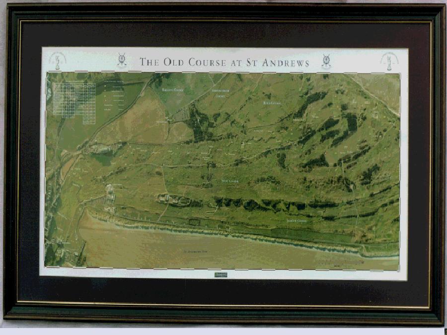
WALL MAP
All the legendary Old Course hazards - from Hell Bunker to the Valley of Sin - are identified on a map which displays a unique precision and wealth of detail. Printed on quality heavy gloss paper suitable for framing, the wall version is produced at scale 1:2500. It measures 970mm x 420mm (approx 48" x 27") and is attractively packaged in a green leatherette container for easy carriage. To frame copies of the wall version Photomaps recommend the use of a claret or green dry mounting and Perspex (for safe delivery) or glass frontage. As with the folded version, this map has the approval of the St Andrews Links Trust as an endorsed product. An executive licence has been secured from the Trust until the end of the century. Just like the folded version, limited copies of the wall map are available with the Claret Jug logo of the R&A to commemorate this year's Open Championship.
As officially approved products, a percentage of revenue from sales of both maps goes towards the maintenance and upkeep of the St Andrews Links Courses.